1

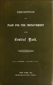
Description of a plan for the improvement of the Central Park — Background and Themes
(0 User reviews)
845
Project Gutenberg
2024
Not confirmed
Central Park (New York, N.Y.)
Readers of public-domain and historical texts
Project Gutenberg digital edition
en
Edition facts
Words
12,137
Reading time
53 min
Text sections
4
Before opening Description of a plan for the improvement of the Central Park — Background and Themes, the edition data offers a quick orientation: 12,137 words, 53 min estimated reading time, and 4 detected text sections.
The text analysis averages about 30.3 words per sentence, while the detected sections provide another way to judge how the source is divided.
Project Gutenberg metadata also associates the work with “Central Park (New York, N.Y.),” connecting these edition facts with the source record’s subject description.
Source:
Project Gutenberg record #73830
Olmsted and Vaux's 1858 plan for Central Park reveals a deliberate contrast between the city's confined lines and the park's sweeping horizon, with detailed topographical reasoning for roads, plantings, and recreational spaces.
Editorial Edition Score
4.5/5
★★★★★
★★★★★
Calculated from edition completeness, EPUB availability, text structure and catalogue metadata. Not a user rating.
How this score is calculated
- Description quality20 pts
- Title & short description10 pts
- Source metadata20 pts
- Text length15 pts
- Chapters / structure15 pts
- EPUB file integrity20 pts
Total of 100 points, scaled to a 2.5-5.0 range. Editions with an empty description or a missing EPUB file are not scored.
Edition quality
Read the Text
Italic text is denoted by _underscores_.
Footnote anchors are denoted by [number], and the footnotes have been placed at the end of the paragraph.
Some minor changes to the text are noted at the end of the book.
“Meantime, with cheap land, and the pacific disposition of the people, everything invites to the arts of agriculture, of gardening, and domestic architecture. Public gardens on the scale of such plantations in Europe and Asia, are now unknown to us. There is no feature of the old countries that strikes an American with more agreeable surprise than the beautiful gardens of Europe; such as the Boboli, in Florence, the Villa Borghese, in Rome, the Villa d’Este, in Tivoli, the gardens at Munich, and at Frankfort on the Maine: works easily imitated here, and which might well make the land dear to the citizen, and inflame patriotism.”—_Emerson_, 1844.
PLAN FOR THE IMPROVEMENT
[F. L. OLMSTED CALVERT VAUX.]
_The Aldine Press._—Sutton, Bowne & Co., 23 Liberty St., N. Y.
The following Description was prepared in 1858 to accompany the first study of our design for the Central Park, the appended woodcut being printed with the Report.
A few notes are added in this edition, together with a map showing to what extent the intention of the plan has, thus far, been realized and in what manner the study has been elaborated.
[Sidenote: Topographical suggestions.]
A general survey of the ground allotted to the park, taken with a view to arrive at the leading characteristics which present themselves as all-important to be considered in adapting the actual situation to its purpose, shows us, in the first place, that it is very distinctly divided into two tolerably equal portions, which, for convenience sake, may be called the upper and lower parks.
[Sidenote: The upper park.]
The horizon lines of the upper park are bold and sweeping and the slopes have great breadth in almost every aspect in which they may be contemplated. As this character is the highest ideal that can be aimed at for a park under any circumstances, and as it is in most decided contrast to the confined and formal lines of the city, it is desirable to interfere with it, by cross-roads and other constructions, as little as possible. Formal planting and architectural effects, unless on a very grand scale, must be avoided; and as nearly all the ground between the Reservoir and 106th Street (west of the Boston road) is seen in connection, from any point within itself, a unity of character should be studiously preserved in all the gardening details.
[Sidenote: The lower park.]
The lower park is far more heterogeneous in its character and will require a much more varied treatment. The most important feature in its landscape is the long rocky and wooded hill-side lying immediately south of the Reservoir. Inasmuch as beyond this point there do not appear to be any leading natural characteristics of similar consequence in the scenery, it will be important to draw as much attention as possible to this hill-side, to afford facilities for rest and leisurely contemplation upon the rising ground opposite, and to render the lateral boundaries of the park in its vicinity as inconspicuous as possible. The central and western portion of the lower park is an irregular table-land; the eastern is composed of a series of graceful undulations, suggesting lawn or gardenesque treatment. In the extreme south we find some flat alluvial meadow; but the general character of the ground is rugged and there are several bold, rocky bluffs, that help to give individuality to this part of the composition.
Such being the general suggestions that our survey has afforded, it becomes necessary to consider how the requirements of the Commissioners, as given in their instructions, may be met with the least sacrifice of the characteristic excellencies of the ground.
[Sidenote: Preliminary considerations.]
Up to this time, in planning public works for the city of New York, in no instance has adequate allowance been made for its increasing population and business; not even in the case of the Croton Aqueduct, otherwise so well considered. The City-Hall, the best architectural work in the State, and built to last for centuries, does not at this time afford facilities for one-third the business for which it was intended. The present Post-Office, expensively fitted up some ten years ago, no longer answers its purpose, and a new one of twice its capacity is imperatively demanded. The Custom-House, expressly designed for permanence and constructed to that end at enormous expense less than twenty years ago, is not half large enough to accommodate the present commerce of the city.
Olmsted and Vaux open their 1858 report with a topographical survey that immediately establishes a guiding tension: the park's upper section possesses “bold and sweeping” horizon lines and “great breadth,” which they identify as the “highest ideal” for a park precisely because it stands “in most decided contrast to the confined and formal lines of the city.” This opposition between urban constraint and pastoral expanse drives every subsequent decision about roads, plantings, and structures. The authors insist that formal planting and architectural effects must be avoided “unless on a very grand scale,” and they advocate preserving a “unity of character” across the upper park. The lower park, by contrast, is treated as a more varied terrain where water features, rocky outcrops, and sheltered hollows invite different kinds of use—picnics, strolls, and a winter drive lined with evergreens.
Topography as Design Argument
The report’s structure follows the land itself. Olmsted and Vaux divide the site into “upper and lower parks,” each with distinct treatment. The upper park’s sweeping slopes are to be interfered with as little as possible by cross-roads; the lower park’s irregular ground, including a moist area near Vista Rock, is deemed “remarkably well adapted to what is called in Europe an American garden”—a specialized planting of rhododendrons, azaleas, and kalmias. The authors note that even if the reservoir were absent, “the conformation of the ground is such that the roads would naturally take, to a considerable extent, the direction indicated,” leaving the center undivided by a drive. This reasoning from natural form rather than arbitrary layout is the report’s core method.
Contrasts in Planting and Use
The plan repeatedly pairs opposing effects. The winter drive, about a mile and a half long, is to be “planted somewhat thickly with evergreens,” yet the authors stress that the aim is not a “thick forest, crowded with tall spindling trees” but a “richly wooded country” where single trees and copses have space to develop. Large open glades of grass are introduced among the evergreens to prevent monotony. Similarly, the area near the lake is to have “sufficient openings” for glimpses of water, while “glades of fine turf” offer rest spots. The playground east of the reservoir is described as “well-kept turf, with fine groups and single trees, so planted that they may appear to advantage, and not crowd each other.” Every intervention is calibrated to avoid crowding and preserve a sense of spaciousness.
The Promenade and the Water’s Edge
A key passage explains the promenade’s location by tracing how a road along the water’s edge “will give an opportunity to lengthen out the drive commanding the principal views in this vicinity.” The lake itself is meant to give “a retired and agreeable character to the hill-side beyond,” which is “well adapted for pic-nic parties and pleasant strolls.” The authors also propose converting existing terraces into “berceau walks,” or continuous arbors, to provide access to reservoir gates. These details show how the plan weaves together movement, sightlines, and social use: the promenade is not merely a path but a device for extending views, the lake a tool for creating seclusion, and the arbors a practical link between built and natural elements.
Readers should note that this 1868 reprint includes a map showing “to what extent the intention of the plan has, thus far, been realized.” The text itself is a design document, not a finished description; its value lies in watching the authors argue from the ground up, treating every rock, slope, and existing tree as a constraint to be turned into an opportunity. The report rewards attention to its conditional language—“it is intended,” “appears to be indicated”—which reveals a landscape still in the process of being imagined.
That rainy afternoon, Olmsted’s insistence on the park’s deliberate horizon—its refusal to echo the city’s grid—stayed with me long after I closed the book. It made me think of other places where restraint shapes meaning. I found myself drifting into A History of Chester Cathedral with biographical notices of the Bishops and Deans — Context and Discussion, noticing how stone and silence can hold a similar, quiet spaciousness.
There are no reviews for this eBook.
There are no comments for this eBook.
Reader reflection
Record your reading impressions
A brief reflection can help important ideas stay with you longer.
Your progress
0
/
10
2
Did this book hold your interest?
3
Would you encourage someone else to read it?
4
Did the language feel accessible?
5
What was the strongest part of the book?
6
How would you describe its reading pace?
7
Would you like to discuss this book with someone?
8
How would you rate its originality?
9
What did this book teach you most?
10